If you’re reading this it means you follow my blog or you randomly stumbled across this post or I told you to. If I told you to, congratulations on going to Lane Springs with us this Saturday!!! I’m super excited. So excited, in fact, that today I drove out to Lane Springs and took pictures, then came home and edited those pictures and now I’m sitting here creating this photo guide all because I don’t want you to get lost.
There are 2 parts to this photo guide. Part A details directions to the park itself and Part B gives directions to our super-secret swimmy spot. (Ok, it’s not really that secret, there are signs.) If you already know how to get to Lane Springs then you should skip Part A and go directly to Part B. But if you need a little help finding Lane Springs, for instance, if you are from Illinois and recently moved to St. James then Part A is for you.
A little more info before we dive in. (That was a totally unplanned pun that I decided to keep.):
- Nick, myself and the fam will be at Lane Springs at 9 a.m. so we can establish dominance in our swimmy spot and keep it free from weirdos. You’re welcome to come that early or earlier or later or whatever.
- We’ll be eating lunch out there and this party is strictly BYOPL (bring your own picnic lunch). So if you plan on eating with us please bring food.
- It is illegal to make campfires by the river so let’s not. Try not to bring anything you need to cook.
- It is rocky. Wear river shoes. No, really.
- We like to set up camping chairs in the shallow water. Feel free to bring a chair and do the same. (It’s too rocky to sit on comfortably.)
- There are a lot of crawdads but they aren’t big enough to eat. They are fun to catch and release though so bring a bucket.
- Bring water if you don’t want to get dehydrated.
- It’s $2 per vehicle to park. Bring exactly $2 because you cannot use a debit card or make change.
- There is no place to change except some horrifying outhouses that are filled with spiders and make you hate your life.
Ok! I think that covers it. On to Part A.
PART A – HOW TO GET TO LANE SPRINGS
Meghan, Sammee and I have developed our own weird landmark system for finding Lane Springs because even if you know where it is, it can sneak up on you. So here it is.
- Start by heading South on Hwy 63 (you know, past Lions’ Club Park)
- You know you’re going the right way when you pass these landmarks (all of them are on the right):

The VFW.

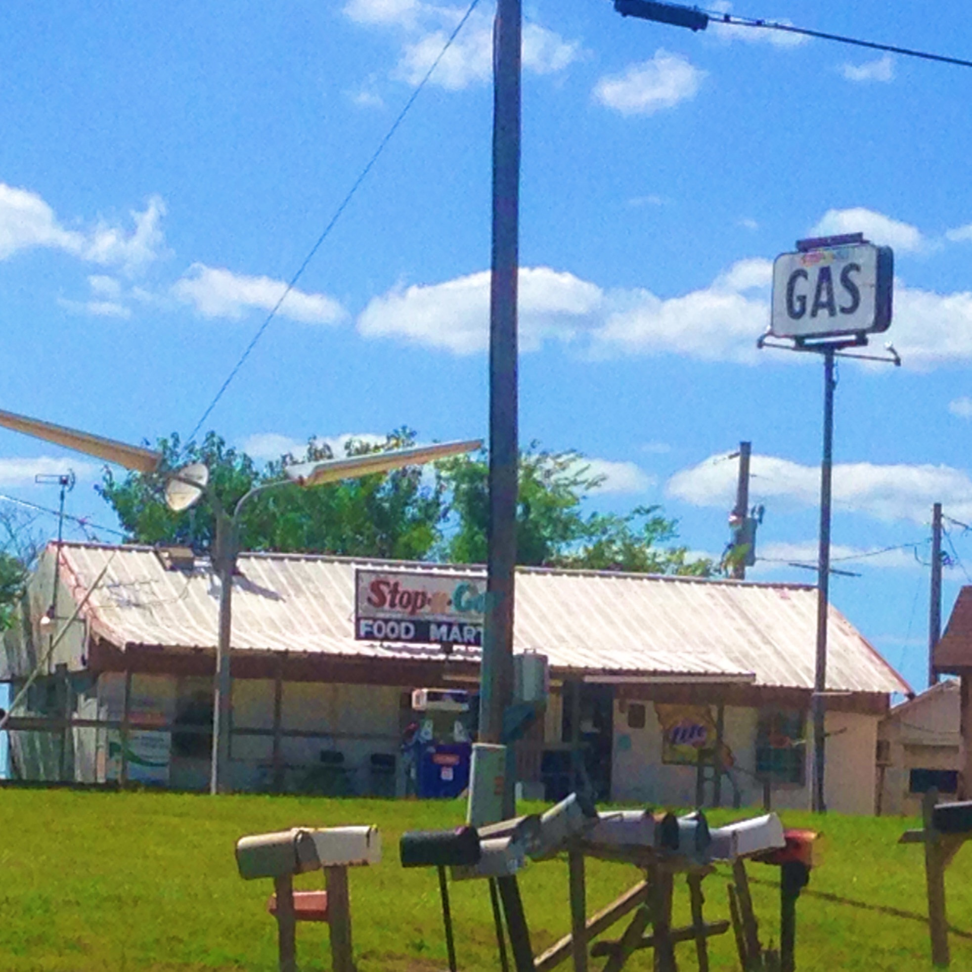
This old Stop-n-Go.

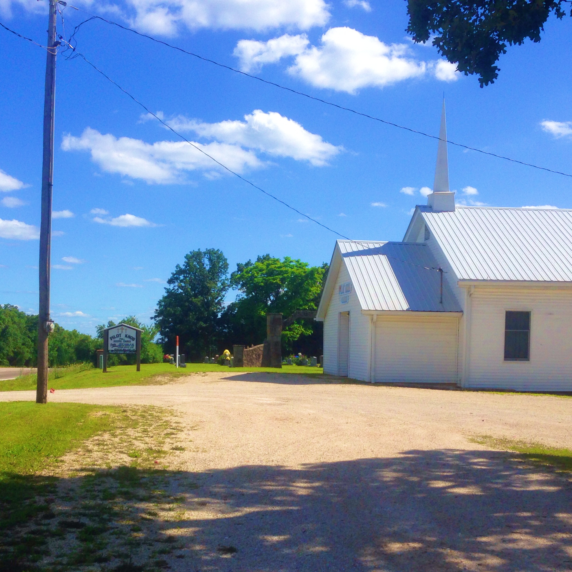
This little country church.

This is the church’s sign.

This weird looking house with orange-ish exterior and green metal roof. (If you look hard enough at the upper left window you’ll see a man who was not too pleased with me for taking a picture of his house.)
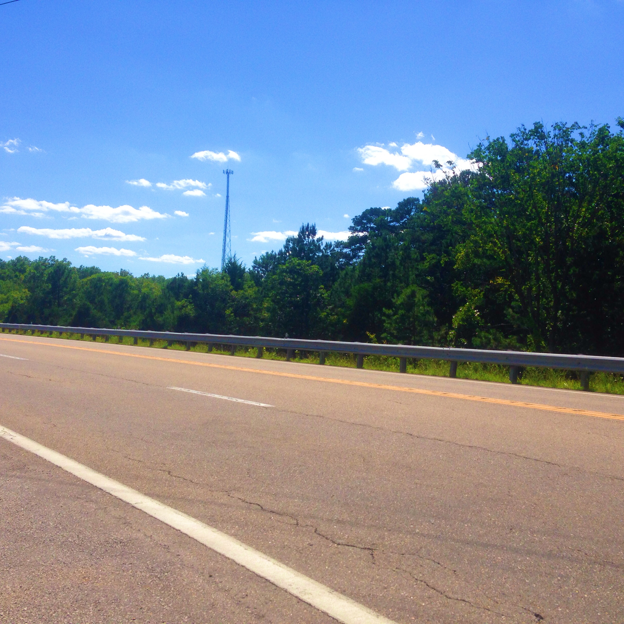
- After you pass the weird little house there will be a guard rail on the right. It looks like this:

(Yes, I really took a picture of the guard rail.)
- Immediately after the guard rail ends turn right onto the little road. It is super easy to miss so be looking for it.
- You have now arrived at:

Turn tape over for Part B. (So many people will not understand that reference at all.)
PART B – HOW TO GET TO OUR SUPER (NOT SO) SECRET SWIMMY SPOT
If you went with us to Lane Springs last year you might remember how to get to our super secret (who am I kidding at this point) swimmy spot. But if you’ve never been or you just forgot, please read on:
- Start by driving into the park. The road from Hwy 63 to the park is long but it only goes one place so don’t be afraid. Also watch out for those hairpin turns and random deer.
- Once you get to the park you’ll be confronted by this sign:

- At this point you must choose,
red pill or blue pill left or right. Go left.
- Let this little sign be your guide:

Follow the arrow.
- After driving only a few yards, you will again be confronted with a choice. Go left. Follow the arrows on this sign:

We’re actually heading to Picnic Area B, not going camping.
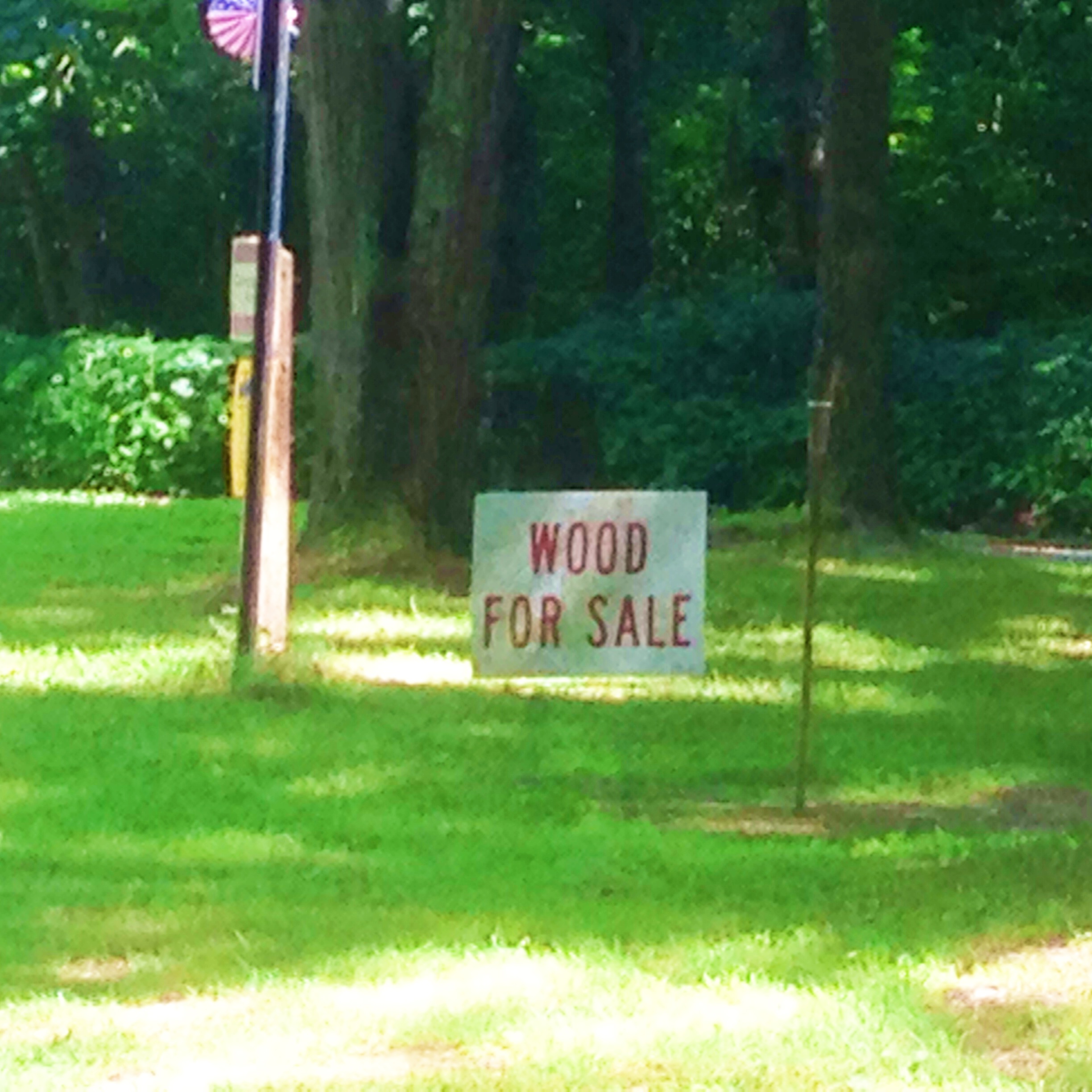
- You’ll go over a speed bump or two (I didn’t bother to count them) and see these things:

Don’t buy any wood. (Unless you really need wood.)

Don’t drive straight into this Fee Area. (I told you we’re not camping.)

Follow this sign and go right.
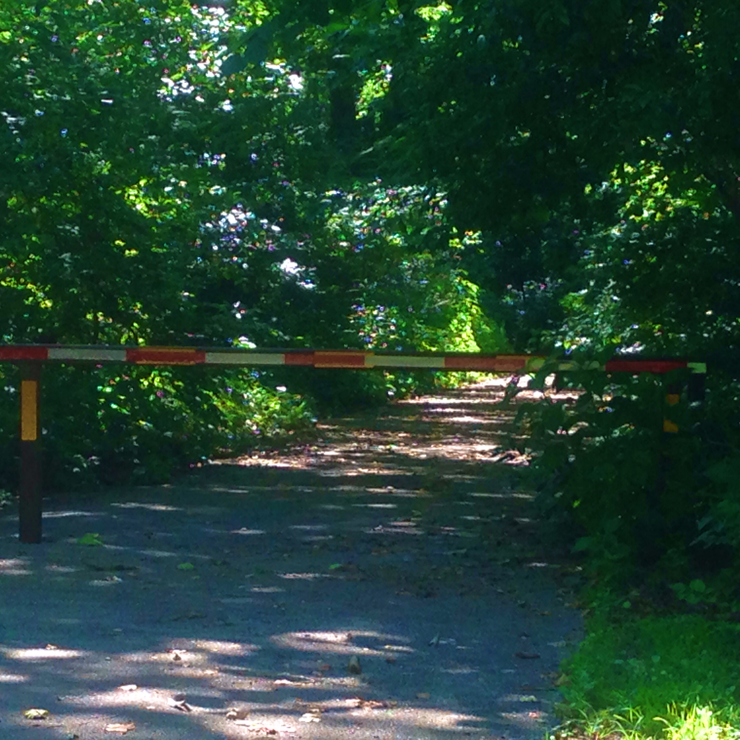
- Stay on the road as it curves to the left so you don’t end up here:

- Park your car, you have arrived at Picnic Area B.
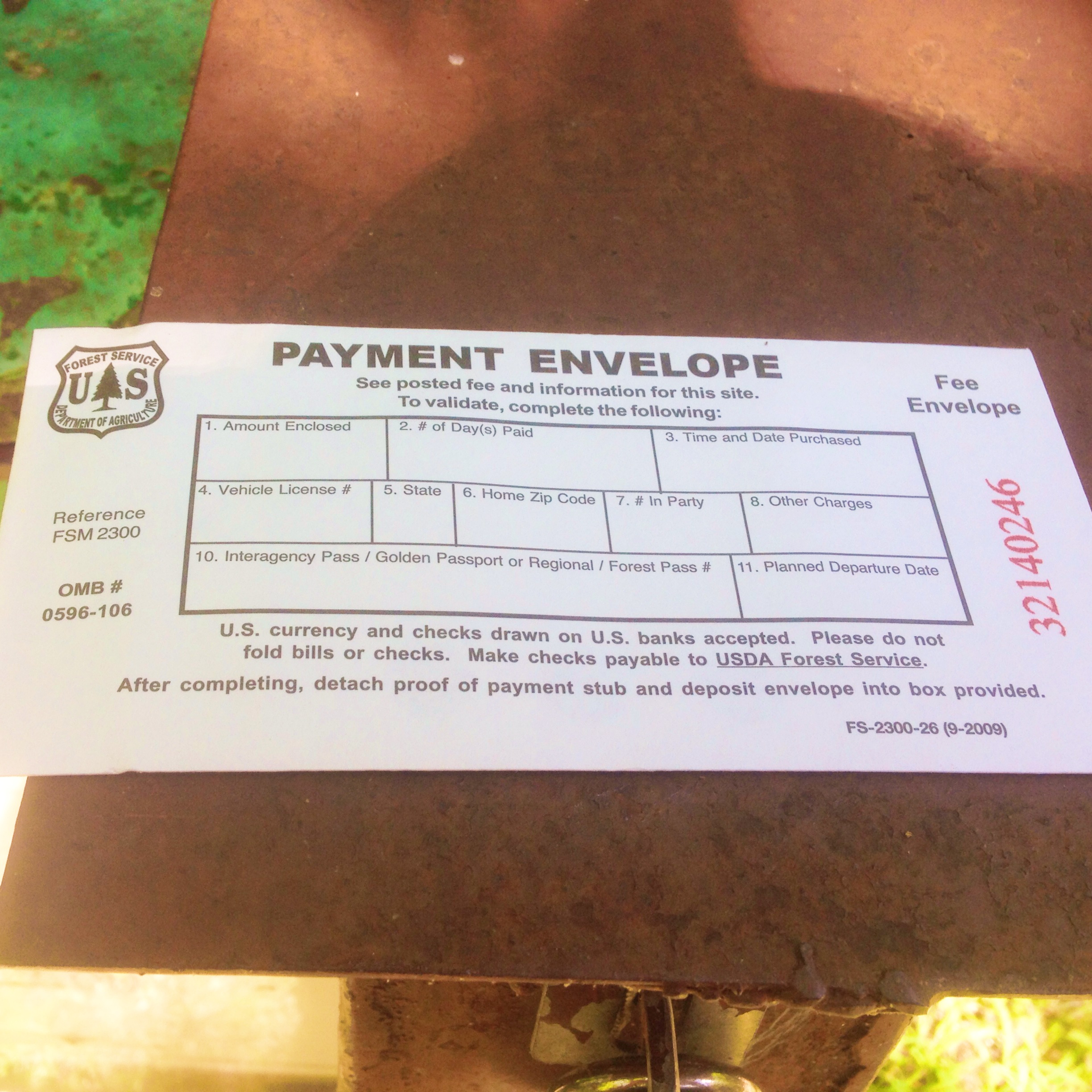
- Put money in this:


Part of this envelope rips off and goes in your car. If you don’t put it in your car you can be ticketed.
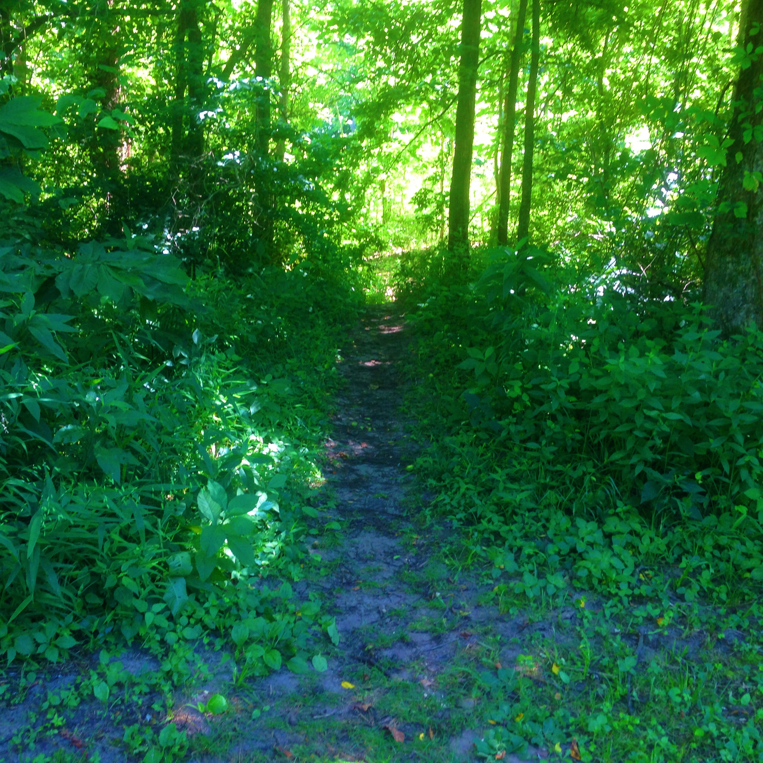
- The trail head to our spot looks like this:

Notice the rock.
- Suddenly the trail comes to a road:

- Again, you wonder, left or right? Neither. Head toward the picnic tables:


By the way, no animals except guide dogs. (Leave your guide cats at home.)
- Next to the sign is another trail head:

Almost there, almost there!
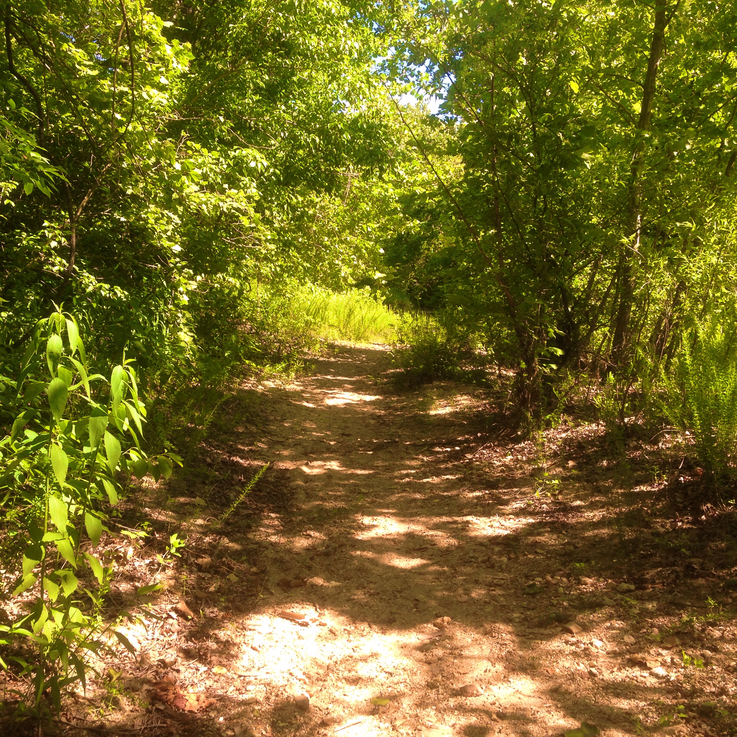
- Keep to the left, the right is yucky.

Don’t be fooled by the sand. It’s all rocks once you come out of the trees.

Congratulations!!!! I’m so proud.
Can’t wait to see you all there. Remember: shoes, food, chairs, no fires, no pets, outhouses of death! Whoopee!